Global commerce relies on a dangerously fragile network of maritime bottlenecks. Ships carrying trillions of dollars in raw materials, consumer goods, and energy supplies pass through a handful of narrow waterways every single day. When a single vessel runs aground or regional instability erupts near these passages, supply chains instantly stall, shipping rates skyrocket, and consumer prices rise worldwide. Understanding maritime trade requires looking past basic maps and examining the geopolitical realities, climate risks, and structural vulnerabilities governing the key canals and straits that keep the world economy afloat.
The Chokepoints Driving Modern Shipping Chaos
Maritime logistics operates on a simple premise: find the shortest distance between production hubs and consumer markets. Artificial canals and natural straits drastically cut transit times, saving millions in fuel and operational costs. However, concentrating massive volumes of traffic into constrained channels creates single points of failure.
A localized incident in a major passage creates immediate backlogs that ripple across ports worldwide. Vessels miss their docking windows, containers pile up on docks, and manufacturers face severe production delays.
The Suez Canal and the Costs of Stagnation
Connecting the Mediterranean Sea to the Red Sea, the Suez Canal handles roughly 12 percent of global trade. It serves as the primary maritime shortcut between Asia and Europe, allowing ships to bypass the long voyage around the southern tip of Africa.
The financial impact of a Suez disruption is swift. When traffic stops, hundreds of container ships, oil tankers, and bulk carriers are forced to anchor, incurring tens of thousands of dollars per day in waiting costs. Rerouting around the Cape of Good Hope adds up to two weeks of travel time and consumes hundreds of tons of additional bunker fuel per ship. These costs pass directly to importers, driving up prices on everything from household electronics to industrial machinery.
The Panama Canal and the Threat of Climate Volatility
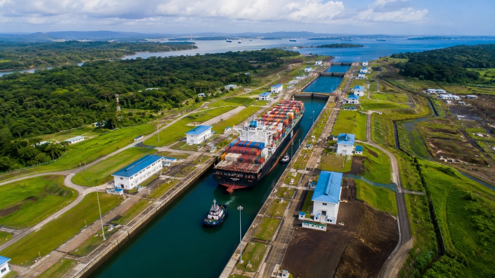
Unlike saltwater passages, the Panama Canal relies on fresh water from Gatun Lake to operate its lock systems. Every ship transit flushes millions of gallons of fresh water into the ocean. When severe droughts strike Central America, water levels drop, forcing port authorities to restrict vessel draft limits and daily transits.
These restrictions force shipping companies into a difficult trade-off. They must either reduce the cargo weight on each ship—leaving profit margins behind—or bid millions of dollars in auctions to secure scarce transit slots. Small operators are frequently priced out, leaving supply chains exposed to unpredictable delays.
Beyond Artificial Waterways
Focusing solely on constructed canals misses half the equation. Natural straits present equal, if not greater, strategic risks to global commerce.
+-------------------+---------------------+-----------------------------------+
| Chokepoint        | Key Region          | Major Risk Factors                |
+-------------------+---------------------+-----------------------------------+
| Suez Canal        | Egypt / Red Sea     | Regional Conflict, Blockages      |
| Panama Canal      | Central America     | Fresh Water Shortages, Drought    |
| Strait of Malacca | Southeast Asia      | Piracy, High Traffic Density      |
| Strait of Hormuz  | Middle East         | Geopolitical Tension, Blockades   |
+-------------------+---------------------+-----------------------------------+
The Strait of Malacca
Funneling traffic between the Indian Ocean and the Pacific Ocean, the Strait of Malacca is the primary corridor for energy shipments heading to East Asia. It measures less than two nautical miles wide at its narrowest point.
Overcrowding in the strait creates severe navigation hazards. Thousands of vessels, ranging from local fishing boats to massive ultra-large crude carriers, crowd the same narrow lanes daily. A major collision or deliberate block in this corridor would force long diversions through the Sunda or Lombok Straits, stretching global tanker capacity to its limits.
The Strait of Hormuz
No maritime passage carries more energy weight than the Strait of Hormuz. Connecting the Persian Gulf to the Gulf of Oman, it acts as the sole sea route for a massive portion of the world's liquefied natural gas and petroleum exports.
Because the strait lies within narrow territorial waters, political tensions directly translate into market volatility. Threats of closure or attacks on commercial tankers immediately cause global crude oil prices to spike, illustrating how security concerns along a single strip of water can spark worldwide inflationary pressures.
Operational Realities and Infrastructure Bottlenecks
Modern container ships continue to grow in size. Ocean carriers deploy massive vessels capable of carrying over 24,000 twenty-foot equivalent units (TEUs) to achieve economies of scale. While these giant ships lower transport costs per container during smooth sailing, they magnify risk when entering narrow channels.
Handling these massive hulls requires precise piloting, powerful tugboats, and deep water channels. When draft depths decrease or unexpected wind shear strikes a vessel's massive surface area, room for error disappears. Infrastructure expansion programs rarely keep pace with the growing dimensions of commercial fleets. Dredging channels and widening locks costs billions of dollars and takes decades to complete, ensuring that physical space inside these waterways remains tight.
The True Cost of Rerouting
When primary trade corridors falter, ocean carriers look for alternatives. None of them are cheap or efficient.
- Cape of Good Hope: Bypassing the Red Sea and Suez Canal adds roughly 3,500 to 4,000 nautical miles to an Asia-to-Europe voyage. This adds significant transit days, burns thousands of additional barrels of fuel, and dramatically increases carbon emissions.
- Overland Rail Services: Transcontinental rail networks offer faster transit times between East Asia and Europe than sea routes. However, rail capacity represents a tiny fraction of ocean shipping volume and remains vulnerable to land-based geopolitical disputes.
- The Arctic Route: Declining polar ice cover has sparked interest in the Northern Sea Route across Russia's northern coast. While it significantly shortens distances between Northern Europe and East Asia, extreme weather, requirement for specialized ice-class ships, and high insurance costs limit its viability as a primary global route.
Preparing for Permanent Disruptions
Logistics executives and supply chain planners no longer view channel blockages or weather delays as rare events. They are recurring operational costs.
Companies are shifting away from rigid, single-source manufacturing models toward regionalization. Nearshoring production reduces reliance on long ocean transits, shielding businesses from maritime bottlenecks. At the same time, ocean carriers are building flexibility into their vessel deployments, holding spare capacity to absorb sudden schedule disruptions. The days of relying on clear, uninterrupted sea lanes are over, and the global economy must adapt to a landscape where every major channel carries inherent risk.