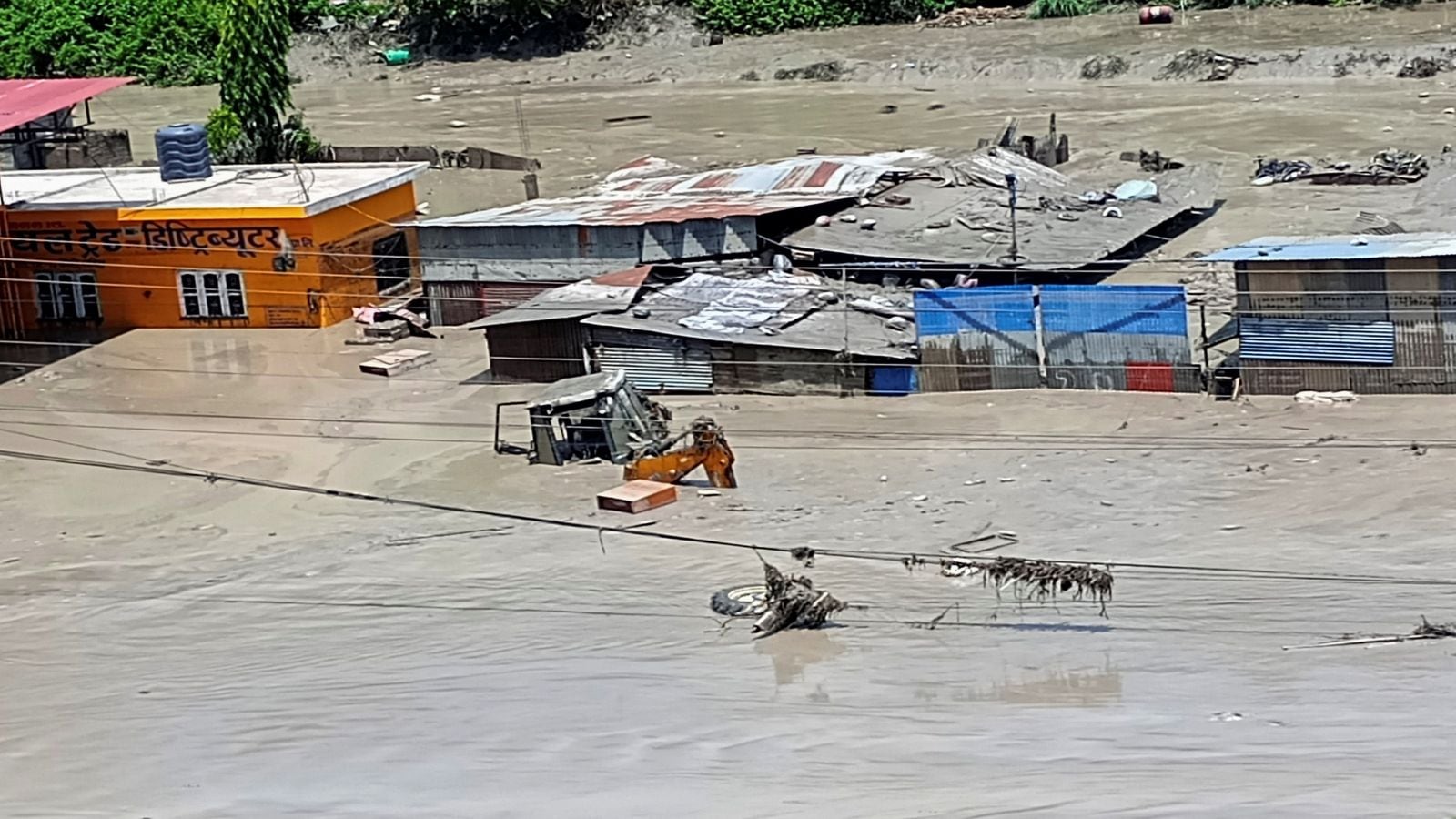
Himalayan watershed instability does not respect sovereign boundaries. When unprecedented precipitation events trigger mass wasting and glacial lake outburst floods in the high-altitude terrain of Nepal, the physical impacts cascade downstream into the densely populated plains of northern India with mathematical certainty. Traditional disaster management treats these incidents as localized meteorological anomalies, but operational reality demands a shift toward transboundary hydrological accounting. The physical mechanics governing these disasters involve steep elevation gradients, accelerated sedimentation rates, and unmanaged catchment loading that transforms rain events into structural kinetic threats.
The Mechanics of Transboundary Catchment Failure
The upstream geography of the Hindu Kush Himalaya functions as a hyper-sensitive conveyor belt for water and debris. Steep slopes combined with fragile, young geological formations create an inherently unstable environment. When extreme weather events concentrate high volumes of rainfall over short durations, the sheer kinetic energy strips mountain slopes of topsoil and weathered rock. This material enters river networks as hyper-concentrated sediment flows, commonly known as debris flows, which dramatically increase the effective volume and destructive capacity of the water.
Downstream riverbeds in the Indo-Gangetic plain lack the gradient required to transport high bedloads efficiently. As water velocity drops upon reaching flatter terrain, suspended sediment drops out of the flow and deposits on the riverbed. This process, known as aggradation, progressively raises the bed level above the surrounding floodplain. Levees and embankments constructed to manage historical baseline flows become structurally obsolete as the channel capacity shrinks. The system reaches a tipping point where minor precipitation increases trigger catastrophic out-of-bank spilling, bypassing engineered defenses entirely.
Urban development patterns along these river corridors exacerbate the hazard. Encroachment on natural floodplains removes the system's primary attenuation mechanism. Wetlands and low-lying agricultural zones that previously functioned as natural retention basins are replaced with impermeable surfaces, accelerating runoff velocities and concentrating peak discharge into narrow channels.
The Economic Cost Function of Downstream Vulnerability
Assessing the financial toll of transboundary floods requires moving beyond direct asset damage estimates to calculate systemic economic friction. Infrastructure networks including power grids, national highways, and supply chain logistics hubs experience cascading failures when cross-border river basins breach their banks.
- Asset Depreciation and Reconstruction Lag: Physical capital destruction in agriculture and transport sectors outpaces municipal capacity to rebuild, resulting in permanent economic shrinkage for affected districts.
- Factor Input Disruption: Agricultural yields in the Gangetic basin rely on predictable irrigation timing. Sudden inundation during critical crop phases destroys root systems, while subsequent dry spells expose the limitations of silt-choked irrigation canals.
- Fiscal Externalities: Central governments absorb the fiscal shock through emergency disaster relief funds, diverting capital away from productivity-enhancing infrastructure investments.
The cost function is non-linear. A marginal increase in upstream deforestation or unmonitored road construction correlates exponentially with downstream remediation expenses. Standard cost-benefit analyses utilized by regional planners routinely fail to incorporate these systemic externalities because they evaluate watersheds within rigid national boundaries rather than unified hydrological systems.
Geopolitical Friction in Early Warning Architecture
Effective disaster mitigation relies on real-time data exchange across international borders. Weather systems do not pause at checkpoints, yet hydrological telemetry data often faces bureaucratic friction before reaching downstream emergency response agencies. River basins shared between nations require synchronized sensor networks and open-source data sharing agreements. When upstream authorities withhold or delay discharge metrics due to institutional inertia or political sensitivities, downstream populations lose critical response windows.
Establishing an operational early warning framework requires decoupling technical data sharing from broader geopolitical negotiations. Telemetry stations positioned at high-altitude glacial lakes and tributary confluences must feed data into a centralized, automated predictive model. This model should output probabilistic inundation maps directly to municipal response units, bypassing hierarchical approval chains that introduce fatal latency into the emergency response lifecycle.
Furthermore, standardization of data collection protocols remains a persistent operational bottleneck. Discrepancies in measurement units, telemetry hardware compatibility, and baseline hydrological mapping between neighboring countries prevent the formation of a unified situational awareness picture. Resolving these technical integration challenges is a prerequisite for any credible regional risk reduction strategy.
Operationalizing Basin-Wide Resilience
Mitigating the risks posed by cross-border Himalayan floods demands a transition from reactive engineering to proactive spatial planning. Hard infrastructure solutions, such as raising embankments or constructing concrete retaining walls, offer diminishing returns and often create a false sense of security that encourages further floodplain development.
Strategic intervention must begin with sediment management at the sub-catchment level. Check dams and sediment retention basins constructed in upper tributary zones can trap bedload material before it reaches the main channel, preserving downstream carrying capacity. Simultaneously, zoning laws must be enforced to prohibit permanent construction within designated high-risk floodways, utilizing these zones instead for agroforestry or seasonal aquaculture that can withstand periodic inundation without structural loss.
Regional disaster management frameworks must institutionalize joint basin commissions endowed with executive authority to coordinate water release schedules from major barrages and dams during extreme weather events. These commissions should mandate synchronized stress-testing of all structural defenses annually, utilizing high-resolution digital elevation models to simulate worst-case breach scenarios.
Implement automated sensor grids across all high-risk transboundary river corridors by the end of the fiscal cycle, tying raw telemetry directly to municipal automated alert systems to eliminate human latency in emergency evacuation protocols.