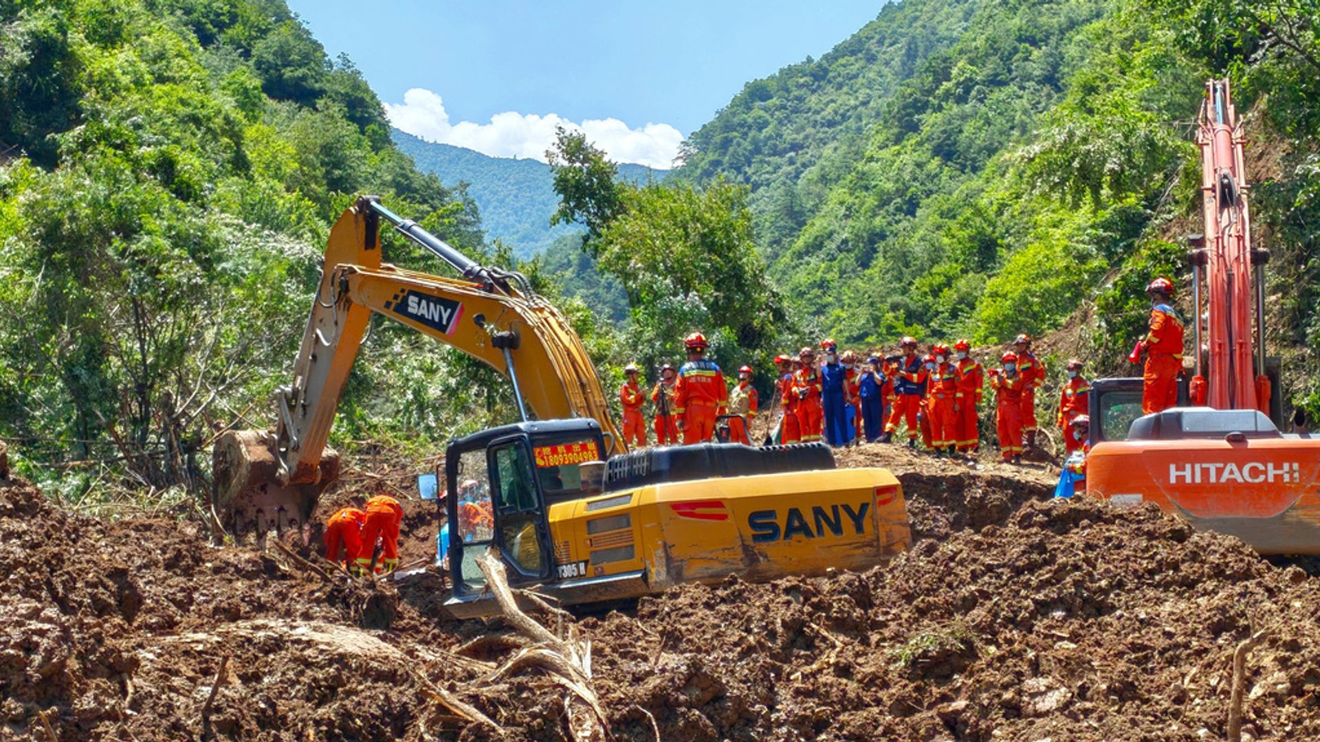
Geological failures represent a complex interaction between static environmental vulnerabilities and dynamic triggers. When a landslide occurs, public reporting typically focuses on immediate casualties and surface-level rescue logistics. A rigorous structural analysis, however, requires evaluating the event through three distinct operational vectors: the mechanical failure criteria of the slope, the structural logistics of the search and recovery envelope, and the systemic risk-mitigation framework of the surrounding infrastructure. Dissecting an event involving a sudden mass wasting incident in a mountainous region—such as the recent slope failure in China resulting in five confirmed fatalities and twelve individuals trapped—demands moving past basic reporting toward a mechanistic understanding of slope stability and disaster lifecycle management.
The Triad of Slope Instability: Mechanical and Hydrological Drivers
Every landslide operates under fundamental laws of soil mechanics and shear strength. A slope fails when the shear stress along a potential slip plane exceeds the shear strength of the soil or rock mass. This relationship is quantified by the Mohr-Coulomb failure criterion, which establishes that shear strength depends on cohesion, normal stress, and internal friction angle.
Understanding why a specific hillside collapses involves analyzing three primary variables that alter this balance:
- Pore Water Pressure Elevation: Water infiltration from heavy rainfall or rapid snowmelt fills the void spaces within soil particles. This does not merely add weight to the slope; it creates positive pore water pressure that pushes soil particles apart, directly reducing the effective normal stress and stripping the slope of its frictional shear strength.
- Geometric Modification: Human interventions, such as cutting the toe of a slope for roads or mining operations, remove the natural structural support holding back the upper mass. Conversely, loading the crest with infrastructure increases the driving shear stress.
- Lithological Vulnerability: Weathered bedrock, highly fractured shale, or unconsolidated colluvium possess low intrinsic cohesion, leaving them highly susceptible to failure under minor seismic or hydrological triggers.
When these factors intersect, the safety factor—the ratio of resisting forces to driving forces—drops below 1.0, triggering an instantaneous, catastrophic displacement of material.
The Search and Recovery Envelope: Operational Bottlenecks in Unconsolidated Material
Once a failure occurs, the primary operational challenge shifts from geotechnical engineering to search and rescue logistics. The immediate survival window for individuals trapped beneath a landslide is exceptionally narrow, dictated by asphyxiation, crush injuries, and hypothermia.
Managing this response envelope involves overcoming acute physical and logistical bottlenecks.
Structural Instability of the Debris Field
The displaced mass is inherently unstable. Excavating material from the toe of a landslide debris field can reactivate the slide, endangering both the trapped individuals and the rescue personnel. Responders must continuously monitor the upper slope using terrestrial laser scanning (LiDAR) or interferometric synthetic aperture radar (InSAR) to detect millimeter-level movements that signal an impending secondary collapse.
Mass-Volume Discrepancies
The sheer volume of material involved in a typical hillside failure creates a significant logistics deficit. Clearing thousands of cubic meters of rock and mud requires heavy machinery, yet the fragile nature of the debris field often forces initial efforts to rely on manual labor and canine teams to avoid crushing survivors. This creates a severe operational trade-off between the speed of excavation and the safety of the victims.
The Void Space Paradox
Survival depends entirely on the creation of accidental void spaces within the debris. In a rockfall or structural collapse, rigid materials frequently bridge over one another, creating survivable pockets. In a highly saturated earthflow or mudslide, the material behaves like a viscous fluid, filling all available volume and reducing the probability of finding viable void spaces to near zero.
Risk Attribution and Predictive Infrastructure Gaps
Evaluating these disasters requires assessing the systemic failures in hazard mapping and early warning systems. Modern geotechnical engineering possesses the tools to anticipate these events, meaning that unexpected mass casualties often indicate gaps in systemic risk application rather than a lack of scientific capability.
Effective mitigation relies on a multi-layered defensive framework. First, deep-seated regional risk identification requires historical inventory mapping combined with satellite-based deformation monitoring. Areas exhibiting steady, millimeter-scale downslope creep represent highly probable failure zones.
Second, local deployment of automated instrumentation must be standard practice for high-risk slopes adjacent to human settlements. This includes installing in-ground extensometers to measure structural strain, piezometers to track critical pore water pressure thresholds, and tiltmeters on surface structures.
The breakdown occurs when these data streams are not integrated into actionable, localized emergency evacuation protocols. If the threshold criteria for rainfall accumulation or slope displacement fail to trigger an immediate, mandatory relocation of populations down-gradient, the analytical value of the monitoring hardware drops to zero.
Strategic Directives for Geotechnical Asset Protection
Mitigating future loss of life in high-relief topography requires transitioning from reactive disaster response to predictive structural asset management.
- Implement Mandatory Geotechnical Zoning Laws: Prohibit high-density residential development within defined runout zones of slopes exceeding critical angle thresholds, irrespective of historical stability.
- Deploy Continuous Real-Time InSAR Monitoring: Municipalities in mountainous corridors must establish continuous satellite radar monitoring loops to detect pre-failure deformation acceleration before visual fissures manifest on the surface.
- Construct Active Structural Mitigation Systems: Where relocation is unfeasible, invest in engineered retention systems. This includes installing deep-anchored rock bolts, high-tensile steel wire mesh draping, and bored piling walls coupled with sub-surface drainage galleries designed to channel pore water away from critical failure planes.