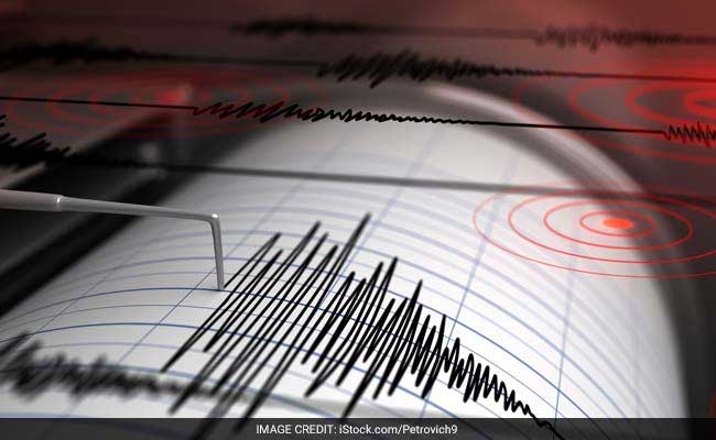
Seismic events occurring off the coast of archipelagic nations are routinely processed by the public as immediate precursors to catastrophic marine inundation. However, the 6.5-magnitude earthquake that struck the Celebes Sea near Balut Island, Sarangani, on June 26, 2026, serves as a textbook baseline for separating raw seismic magnitude from structural tsunami risk. While standard media reporting focuses on the binary existence of a warning, an analytical assessment reveals that the absence of a tsunami alert was not a matter of fortune, but a direct consequence of three deterministic geophysical variables: focal depth, fault slip mechanics, and localized bathymetric profile.
Understanding this event requires contextualizing it within a highly destabilized regional lithosphere. This 6.5-magnitude event occurred less than three weeks after a massive 7.8-magnitude subduction earthquake along the northern Sangihe Trench and southern Cotabato Trench on June 8, 2026. The June 8 event caused severe shallow crustal displacement, widespread infrastructure failure across Mindanao, and a confirmed 2.5-meter localized tsunami. Consequently, evaluating the June 26 event requires a structural diagnostic of why a major magnitude shock failed to trigger a secondary marine disaster in an already compromised seismic zone.
The Tri-Variable Tsunami Risk Function
To quantify why some offshore earthquakes displace water columns while others merely vibrate them, seismologists evaluate events through a strict tri-variable risk function. A tsunamigenic event requires the simultaneous convergence of shallow focal depth, vertical dip-slip fault displacement, and shallow water column interaction. The June 26 Celebes Sea event failed to meet these critical structural thresholds.
                  [ SEISMIC ENERGY RELEASE (M 6.5) ]
                                  │
                   Is Focal Depth < 30 Kilometers?
                                  ├───► NO: Energy absorbed by lithosphere.
                                  │         (June 26 Event: 52-55 km Depth)
                                  ▼ YES
               Is Fault Motion Vertical (Thrust/Normal)?
                                  ├───► NO: Horizontal strike-slip motion.
                                  │         Minimal vertical water displacement.
                                  ▼ YES
            Does Displaced Sea Floor Transfer Energy to Water?
                                  ├───► NO: Deep bathymetric dampening.
                                  ▼ YES
                     [ destructive tsunami generated ]
1. Focal Depth Dissipation
The National Centre for Seismology (NCS) and the United States Geological Survey (USGS) localized the June 26 hypocenter—the actual subterranean point of origin—at a depth between 52 and 55 kilometers. This classification places the event firmly in the mid-depth category, separating it fundamentally from shallow crustal events (0 to 30 kilometers deep) that pose severe surface hazards.
When a fault ruptures at 55 kilometers beneath the ocean floor, the kinetic energy released must propagate through massive volumes of overlying lithospheric rock before reaching the solid-fluid interface of the seabed. This dense rock acts as a low-pass mechanical filter, damping the high-frequency shear waves ($S$-waves) and primary compressive waves ($P$-waves). By the time the seismic energy reaches the sea floor, the localized acceleration is insufficient to cause the instantaneous, large-scale deformation of the crust required to launch a coherent deep-water wave train.
2. Kinematic Fault Motion Mechanics
Seismic monitoring instruments indicate the June 26 event occurred near the convergence zone of the Cotabato Trench and the Sangihe Trench. While the devastating June 8, 7.8-magnitude earthquake was characterized by violent thrust faulting—where one side of the fault is forced upward, driving the water column vertically—initial focal mechanism solutions for the June 26 event indicate a shift toward horizontal or highly inclined strike-slip adjustments.
Tsunamis are driven by gravity seeking to restore equilibrium to a vertically displaced column of water. If a fault moves horizontally, the lateral friction changes the contours of the sea floor slightly but fails to lift or drop the water column above it. Without vertical displacement of the seafloor boundary layer, the potential energy of the ocean remains zero, eliminating the mechanical engine of a tsunami wave.
3. Bathymetric Dampening in the Celebes Sea Trench System
The bathymetry—or underwater topography—surrounding Balut Island and the wider Celebes Sea features deep trench structures, with depths rapidly plunging beyond 3,000 meters. The depth of the water column introduces a severe scale mismatch for mid-magnitude earthquakes.
For a 6.5-magnitude event at a depth of 55 kilometers, the volumetric displacement of the seabed, if any, is localized to a small footprint. When this footprint interacts with a ultra-deep water column, the volume of water acting as a shock absorber is massive. The upward kinetic energy is distributed across a deep vertical column, dampening any wave amplitude at the surface to imperceptible millimeter-scale oscillations. This stands in stark contrast to shallow coastal shelves where even minor vertical displacements can compress the water column and force a visible wave surge.
The Aftershock Cascading Matrix
A primary challenge for structural engineers and disaster risk managers in Mindanao is differentiating between independent tectonic events and the cascading aftershock matrix of the June 8, 7.8-magnitude earthquake. The June 26 event highlight a critical bottleneck in seismic risk communication: the compounding vulnerability of infrastructure.
The June 8 earthquake altered the regional stress field across southern Mindanao, releasing an equivalent seismic moment of $6.14 \times 10^{20} \text{ N}\cdot\text{m}$ and generating over 7,400 recorded aftershocks. When a 6.5-magnitude event occurs within this hyper-stressed zone, its primary hazard is not the generation of a new ocean wave, but the structural degradation of onshore facilities already weakened by prior seismic load.
The mechanical reality of successive shocks can be modeled through cumulative fatigue frameworks:
- Initial Elastic Capacity: Prior to June 8, civil infrastructure across General Santos City and Sarangani operated with a baseline reserve capacity designed to withstand standard seismic coefficients.
- Plastic Deformation Phase: The June 8 mainshock pushed thousands of concrete structures past their elastic limits into plastic deformation, causing micro-fissures, retaining wall tilt, and soil liquefaction.
- The Secondary Loading Effect: While a 6.5-magnitude earthquake at a 55-kilometer depth rarely collapses modern structures on its own, its arrival on June 26 acted as a secondary loading phase. Weakened structural elements undergo rapid cycle fatigue, causing sudden structural failures in buildings that had been visually cleared but remained internally compromised.
Structural Mitigation Protocol
Given the continuous tectonic adjustments along the Cotabato and Sangihe trench systems, regional operations teams must shift from reactive monitoring to proactive structural triage. Relying entirely on automated warning systems like those managed by PHIVOLCS is necessary but insufficient for systemic resilience.
First, municipal engineering offices across Mindanao must deploy immediate, mandatory non-destructive testing (NDT) on all critical supply-chain infrastructure, specifically bridges along the coastal highways of Glan and Jose Abad Santos. Visual inspections are fundamentally flawed in post-subduction environments; ultrasonic pulse velocity testing is required to identify internal voiding in concrete piers subjected to multi-event shaking.
Second, the geographical reality of coastal elevation changes must be integrated into logistics planning. The June 8 event permanently raised portions of the Sarangani coastline by up to 2 meters and shifted it seaward. This alter the baseline parameters of local ports and littoral zone bathymetry. Marine transport networks must re-map shallow-water access channels to ensure emergency supply chains remain viable during subsequent seismic adjustments.
The June 26 Celebes Sea earthquake confirms that magnitude is an incomplete metric for assessing oceanic hazard. Deep-seated hypocenters and strike-slip kinematic profiles inherently isolate the marine surface from tsunamigenic activation. The immediate strategic priority must remain onshore, mitigation of structural fatigue within the built environment, as the regional fault systems continue to distribute residual lithospheric stress.


