When the White House released an executive order mandating that the federal government refer to Lake Ontario as Lake America, public commentary largely dismissed it as political theater. Trade disputes between Washington and Ottawa had just boiled over into fifty percent tariffs on billions in cross-border goods, providing a loud backdrop for what many assumed was a superficial distraction. Yet, examining this administrative decree purely as a joke misses the broader, calculated weaponization of geographic information systems. Cartography has never been a neutral science. Maps reflect power dynamics, and the current administrative strategy treats digital geography as malleable territory to be conquered by executive fiat.
President Donald Trump signed the directive in the Oval Office, flanked by maps bearing the new red-lettered nomenclature. This followed a playbook established on day one of his second term when the Gulf of Mexico was officially rebranded as the Gulf of America in federal databases. But renaming a shared international body of water bordering New York and the province of Ontario creates immediate friction points across digital infrastructure, legal frameworks, and international diplomacy.
The Limits of Executive Cartography
Federal agencies like the Department of the Interior maintain the Geographic Names Information System (GNIS), which dictates standard naming conventions for U.S. maps. When the executive branch orders an update to the GNIS, domestic mapping applications face an immediate compliance dilemma. Within days, global tech platforms adjusted their U.S.-facing interfaces. Google Maps updated its rendering for American users to display Lake America, while preserving Lake Ontario for Canadian viewers and displaying dual labels for international audiences.
This bifurcation of digital reality illustrates a troubling precedent for information integrity. Algorithms now fragment geographical truth based on the user's IP address. A fisherman launching a charter boat out of Rochester, New York, accesses a different digital map than a captain casting lines out of St. Catharines, Ontario.
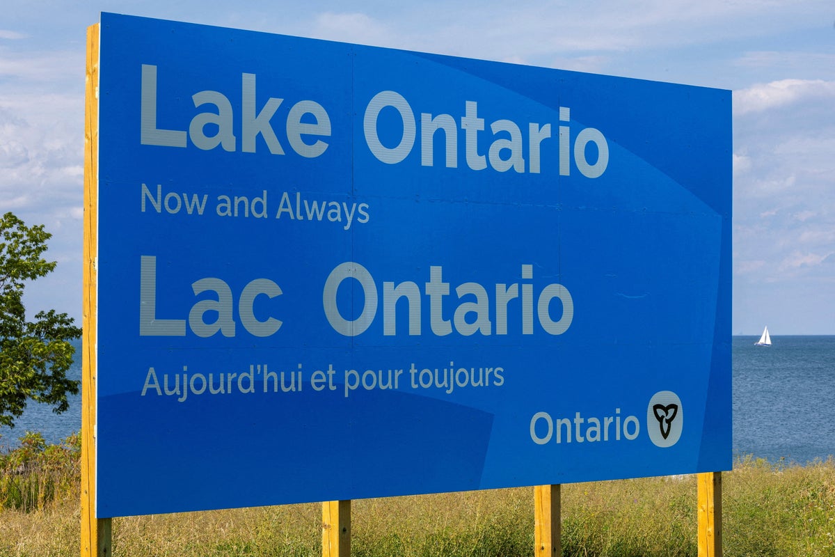
However, the executive order stops abruptly at the international boundary line. Sovereignty over a body of water shared by two nations cannot be unilaterally rewritten by presidential decree. Canadian Prime Minister Mark Carney rejected the move instantly, highlighting that the name Ontario derives from the Indigenous Wendat language—signifying a magnificent body of water—predating both modern nations. Provincial leaders like Ontario Premier Doug Ford escalated the response by erecting massive physical signage along the northern shore declaring the original name permanent, while state governors on the American side, including New York’s Kathy Hochul, publicly distanced themselves from the new nomenclature.
Economic Retaliation Behind the Maps
The timing of the hydrographic rebranding is tied directly to an aggressive trade war. With supply chains choked by retaliatory tariffs affecting steel, aluminum, dairy, and consumer products, the White House utilized nationalist symbolism to pressure Ottawa. Trade negotiators find themselves deadlocked, and administrative provocations serve to keep domestic constituents mobilized while punishing traditional allies.
Bilateral relations between the United States and Canada have deteriorated to a level unseen in decades. Suggestions from Washington that Canada should absorb status as the fifty-first state have transformed from offhand remarks into structural diplomatic insults. Changing the name of a Great Lake is designed to sting, mocking the deep historical ties and integration of the North American continent.
The Corporate Scramble for Compliance
Private mapping and navigation companies are caught in the crossfire of this digital nationalism. While major players accommodate federal data standards to protect domestic regulatory standing, smaller independent application developers face severe brand positioning choices. Some enterprises experience sudden spikes in traffic or consumer backlash depending on whether they adopt or mock the federal designation.
Data sovereignty relies on trusted, uniform standards. When political actors begin treating latitude, longitude, and place names as variables subject to executive whims, the foundational trust supporting global logistics begins to fracture. Commercial shipping fleets, marine insurers, and environmental monitoring agencies depend on a single, shared reality.
The physical water remains indifferent to administrative titles. It flows through locks and rivers toward the St. Lawrence, carving through the bedrock regardless of what pixels appear on a smartphone screen in Washington. Yet the ease with which digital infrastructure bends to political pressure demonstrates how fragile our shared consensus of reality has become.
Physical borders are defended with treaties and tariffs, but digital borders are rewritten with a keystroke. As long as economic friction between the neighbors persists, the maps will remain a battleground, reflecting a deeper unwillingness to compromise on shared spaces.