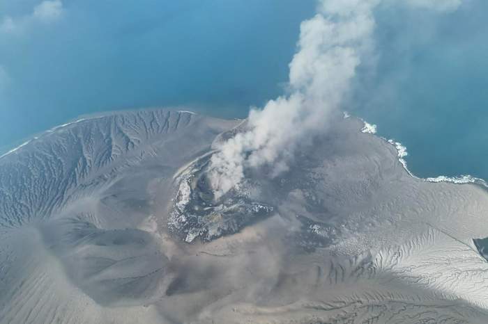
When Mount Anak Krakatau blew its top in the Sunda Strait, sending an ash plume soaring 50,000 feet into the stratosphere, the immediate casualty was not just local scenery, but global aviation logistics. Over three hundred flights ground to a halt at Jakarta’s Soekarno-Hatta International Airport alone, stranding tens of thousands of passengers and demonstrating how a thirty-second geological burp can paralyze the transit arteries of Southeast Asia. Headlines around the world quickly reduced the disaster to a simple numbers game of canceled tickets and stranded tourists. They missed the structural vulnerability underlying the entire system.
Air traffic management across the Pacific Ring of Fire operates on a razor-thin margin of safety that modern commercial aviation technology struggles to reconcile with raw planetary violence. Volcanic ash is not mere dust; it is pulverized glass, rock, and mineral fragments. When ingested into a high-bypass turbofan jet engine operating at temperatures exceeding 1,400 degrees Celsius, this particulate matter melts instantly. It coats turbine blades, chokes cooling channels, and stalls combustion chambers with a glassy glaze. Modern twin-engine jets cannot simply dodge these plumes on intuition. Satellite imagery often lags behind real-time drift, leaving air navigation authorities to choose between massive economic disruption or catastrophic engine failure. Meanwhile, you can find other developments here: The Mountain That Breathes Fire While the Terminal Waits.
The friction point lies in the conservative mandates governing airspace closure. When a volcano erupts in Indonesia, the Darwin Volcanic Ash Advisory Center issues tracking vectors that force blanket groundings across vast polygons of airspace. Airlines lose millions in revenue hourly, while passengers face cascading delays that ripple through international hubs from Singapore to Sydney. Yet, the alternative—relying on pilot line-of-sight or early-generation radar to spot invisible micro-ash particles in the dark—is a gamble no safety officer is willing to take after historical close calls like British Airways Flight 9, which lost all four engines over Indonesia in 1982 after blundering into an unmapped cloud from Mount Galunggung.
Mitigation strategies remain frustratingly primitive. Disaster mitigation agencies rely heavily on reactive closures and ground-level warnings, telling residents to wear masks and stay indoors while airlines scramble to rebook displaced travelers. Weather modification operations, including cloud seeding to wash ash out of the air prematurely, offer localized relief but do nothing to stop high-altitude drift. The economic cost of these shutdowns forces a recurring question about whether predictive modeling can evolve fast enough to isolate safe corridors instead of shutting down entire regional skies. Until real-time LIDAR sensors can be mounted directly on commercial airframes to detect particulate density miles ahead, the archipelago's underground furnace will continue to hold the global travel grid hostage at a moment's notice. To see the full picture, we recommend the excellent report by Lonely Planet.