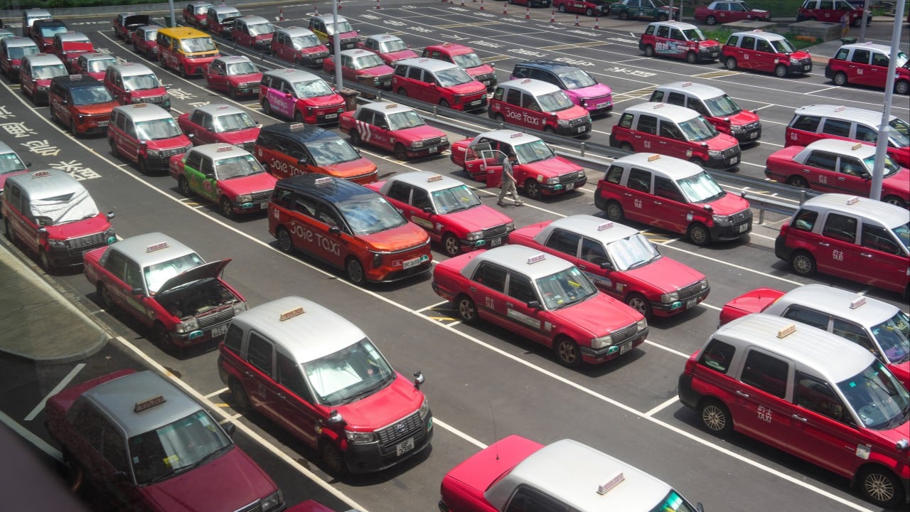
The structural inefficiency of street-hailing taxi systems resides in the information asymmetry between roaming drivers and dispersed passengers. In high-density urban environments like Hong Kong, this friction manifests as sub-optimal fleet utilization, unnecessary localized traffic congestion, and elevated fuel costs. While ride-pooling and app-based dispatch networks have stabilized demand metrics for private hire vehicles, the traditional street-hail market—which represents a significant share of Hong Kong’s daily transit ecosystem—remains governed by heuristic-based roaming. Optimizing this system requires transitioning from intuitive cruising to predictive, data-driven positioning models.
The primary objective is to construct a framework that minimizes the vacant-to-occupied ratio ($V/O$) of the fleet while respecting the operational constraints unique to Hong Kong's geography, regulatory framework, and driver demographics. By processing spatial-temporal telemetry, historical trip distribution patterns, and real-time environmental variables, predictive models can guide non-app drivers to high-probability dispatch zones before the demand materializes. Learn more on a connected issue: this related article.
The Economic Friction of Intuitive Cruising
Traditional taxi operations rely on the heuristic knowledge of individual operators. Drivers position their vehicles based on historical intuition, shift times, and visible queues at designated stands. This approach fails during sudden demand shifts caused by micro-weather events, public transit disruptions, or rapid changes in commercial district foot traffic.
The financial penalty of this information gap can be quantified through the cost function of empty cruising. The total operational cost ($C_o$) of a taxi shift is a function of fixed costs ($C_f$), such as vehicle rental and insurance, and variable costs ($C_v$), primarily fuel and maintenance, which scale directly with kilometers driven: More analysis by Wired highlights comparable perspectives on this issue.
$$C_o = C_f + \int (C_v \cdot v(t)) dt$$
When a driver cruises aimlessly looking for a street hail, the variable cost accumulates without generating revenue. The revenue generation rate ($R$) only activates when the vehicle is occupied. Inefficiency increases when the search time ($T_s$) stretches, depressing the driver’s net margin.
The traditional model creates a spatial mismatch. While hundreds of passengers may queue at the Cross-Harbor Tunnel interchanges or outside commercial complexes in Central during peak hours, uncoordinated drivers may simultaneously cluster in Mong Kok due to lagging historical patterns. This misallocation generates two simultaneous systemic failures: unserved consumer demand and uncompensated driver expenditure.
The Three Pillars of Predictive Demand Modeling
Resolving this spatial mismatch requires a predictive architecture capable of forecasting demand at a granular level. The system must process disparate data streams to generate actionable positioning recommendations. This architecture is built upon three foundational data pillars.
Spatial-Temporal Discretization
To make urban data computationally manageable, the physical environment must be divided into discrete geographic units over specific time intervals.
- Geographic Tessellation: Utilizing continuous GPS coordinates is computationally inefficient for real-time fleet coordination. The urban area is instead mapped using discrete hexagonal hierarchical spatial indexes, such as Uber’s H3 grid or Google’s S2 geometry. Hexagonal cells are chosen because the distance between the center point of a hexagon and its six neighbors is uniform, eliminating the directional distortion inherent in square grids. In Hong Kong's dense layout, a resolution level that yields cells with an edge length of approximately 100 to 150 meters is optimal for capturing street-level demand variations.
- Temporal Binning: Time is partitioned into discrete intervals, typically 5-minute to 15-minute blocks. This granularity is precise enough to capture the immediate impact of events—such as a movie ending or a sudden downpour—without introducing excessive statistical noise into the predictive algorithms.
Telemetry and Historical Ingestion
The core of the predictive engine relies on aggregating historical trip data and live telemetry from the existing fleet.
- Historical Trip Data: This consists of millions of data points logging origin-destination pairs, pickup timestamps, drop-off timestamps, and fare amounts. This data establishes the baseline seasonal variations, separating Monday morning financial district commutes from Saturday night entertainment demand in Lan Kwai Fong.
- Live Fleet Telemetry: Real-time data feeds from GPS tracking units installed in active taxis provide the current supply state. The system maps the density of both occupied and vacant taxis within each hexagonal cell, yielding a live visualization of fleet distribution.
Environmental Covariates
Demand does not exist in a vacuum; it is highly reactive to external catalysts. The predictive engine integrates real-time environmental variables to adjust its baseline forecasts.
- Meteorological Data: Rainfall, humidity, and temperature variations alter commuter behavior. Sudden precipitation triggers an immediate spikes in taxi demand as pedestrians abandon walking or open-air transit options.
- Mass Transit Railway (MTR) Status: The MTR forms the backbone of Hong Kong's transit infrastructure. Any service delay, mechanical failure, or scheduled maintenance instantly redirects thousands of commuters toward the taxi network, creating localized demand shocks.
- Scheduled and Unscheduled Events: Concerts at the AsiaWorld-Expo, sporting events at the Hong Kong Stadium, or unannounced road closures alter the baseline flow of urban movement.
Algorithmic Constraints and Urban Canyons
Deploying predictive positioning models within Hong Kong introduces distinct technical and operational constraints that differ from flat, lower-density urban areas.
Global Positioning System Degradation
The urban topography of Hong Kong, characterized by extreme vertical density and narrow street profiles (often referred to as urban canyons), presents a significant challenge to GPS accuracy. Districts like Tsim Sha Tsui, Central, and Mong Kok suffer from severe multipath interference, where satellite signals reflect off skyscraper glass and concrete before reaching the receiver.
[Satellite Signal]
       \
        \      ____ [Skyscraper]
         \    |    |
          \   |    |
           \  |    |
            `>|____|
           /
          / (Reflected Signal)
         v
  [Taxi GPS Unit] <-- False Position Calculation
This signal bounce introduces positional errors ranging from 20 to over 100 meters. For a predictive system relying on precise street-level cell placement, this error can misclassify a vacant taxi as being on an elevated flyover rather than a ground-level service road.
Mitigating this technical bottleneck requires the integration of map-matching algorithms that utilize dead reckoning. By combining sparse GPS data with the vehicle’s internal odometer and gyroscope inputs, the system snaps the vehicle’s position to the logical road network, validating its true location despite satellite signal degradation.
The Problem of Coordinated Over-Supply
A centralized system that broadcasts a high-demand alert for a specific hexagonal cell risks creating a secondary inefficiency: herds of vacant taxis rushing to the same location. If fifty drivers in the immediate vicinity receive an identical notification to proceed to a specific hotel entrance, the local supply will instantly overwhelm the localized demand.
The resulting bottleneck causes localized traffic congestion, increases wait times for drivers who fail to secure a fare, and wastes fuel across the fleet. To prevent this, the dispatch or recommendation engine must employ a randomized distribution or a capacity-cap mechanism. The system determines the projected deficit of vehicles in a specific cell—for example, a deficit of five vehicles—and only extends the positioning recommendation to five specific vacant drivers within a calculated travel-time radius.
Behavioral Inertia and Demographic Friction
The technical efficacy of an optimization algorithm is fundamentally limited by driver adoption. The demographic profile of Hong Kong taxi drivers skews older, with a significant percentage of operators possessing decades of entrenched driving habits. These operators frequently resist changing their routes based on abstract algorithmic prompts displayed on a screen.
Furthermore, the prevalence of independent owner-operators and fragmented rental structures means there is no centralized corporate mandate to enforce compliance with algorithmic recommendations. Drivers must see immediate, quantifiable financial validation—specifically, a reduction in search time and an increase in daily revenue—to overcome their behavioral inertia. The user interface must therefore prioritize simplicity, delivering clean, non-intrusive directional guidance rather than complex data visualizations that disrupt the driving task.
Structural Strategy for Fleet Integration
Implementing an algorithmic street-hailing support network requires a phased execution strategy that aligns technological capability with the existing commercial framework of the Hong Kong taxi industry.
Phase 1: Passive Data Aggregation and Baseline Training
The initial step focuses on building the data infrastructure without attempting to alter driver behavior immediately. Telemetry collection hardware must be standardized across participating fleets or radio call centers.
- Hardware Standardization: Install connected telematics units capable of broadcasting location, velocity, and meter status (vacant or occupied) at a minimum frequency of 1 Hz.
- Infrastructure Setup: Establish a cloud-based data ingestion pipeline capable of processing thousands of concurrent telemetry streams, cleaning multipath GPS errors through map-matching models.
- Model Training: Train spatial-temporal long short-term memory (LSTM) networks or gradient-boosting trees on historical data, using the environmental covariates to predict cell-by-cell demand coefficients.
Phase 2: Targeted Recommendation Deployment
Once the predictive model achieves an acceptable threshold of accuracy—validated by comparing historical predictions against actual realized trips—the recommendation interface can be introduced to a select cohort of drivers.
[Raw Telemetry + Environmental Data]
               │
               ▼
   [Predictive LSTM Model]
               │
               ▼
[Cell-by-Cell Demand Coefficients]
               │
               ▼
 [Targeted Driver Recommendation] (Restricted to Fleet Cohort)
- Cohort Selection: Deploy the driver-facing application to a trial group of drivers representing different shifts and districts.
- Asymmetric Information Delivery: Direct specific drivers to distinct high-probability zones rather than broadcasting global demand maps, managing supply distribution to avoid the coordinated over-supply bottleneck.
- A/B Performance Verification: Compare the daily revenue, total kilometers driven, and vacant-to-occupied ratios of the trial cohort against a control group of non-app drivers operating under identical shifts and weather conditions.
Phase 3: Regulatory Integration and Infrastructure Expansion
The final stage scales the system by embedding the optimization logic into the broader urban transit management framework.
- Smart Taxi Stand Integration: Equip physical taxi stands in high-congestion zones with digital displays connected to the predictive network. When demand is forecasted to surge, the system can alert nearby vacant drivers via roadside signage, capturing operators who do not use the mobile application.
- Cross-Platform Data Sharing: Partner with municipal transport authorities to ingest live data from smart lampposts and traffic cameras, refining the predictive model's understanding of real-time pedestrian densities and road blockages.
The transition of Hong Kong’s street-hailing ecosystem from a system of localized intuition to one managed by predictive spatial-temporal mapping is an operational necessity. As urban density increases and environmental regulations tighten, the inefficiencies of empty cruising become economically and ecologically unsustainable. By resolving the information asymmetry between driver and passenger through localized, capacity-capped demand forecasting, the transit network can achieve higher throughput without expanding the physical footprint of the fleet.